

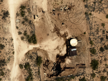
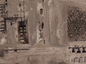
Prius Intelli is a fully integrated geospatial data and services provider which collects and provides high resolution and accurate aerial imagery and elevation data.
Our resolution offerings can be as high as 2.5 cm up to 15 cm, with most orders falling in the 5 to 10 cm range. Dependent on the resolution flown, our accuracies can be within 6” to just over a foot out of the box. We collect our imagery on an order by order basis, so what we normally do is receive an outline (shapefile or kmz) of the particular AOI, then schedule and collect the imagery. Our normal turnaround time from the order being placed to the imagery being delivered within 2-4 weeks, weather dependent. We deliver the imagery in several different ways, from WMS/WMTS links to the .tiffs themselves.
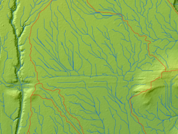
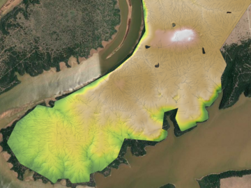
We also leverage the imagery to develop quality derivative work products. Some examples are vector data from the RGB, or elevation data in the way of contour lines, elevation models, stream networks, drainage basins, planimetric data, etc. alongside the RGB imagery.
18 open listings


No followed people
No reviews